Topographic Surveys & Site Plans
If you need a professional topographic survey in Vermont, New Hampshire, New York, or anywhere in the Northeast, the team at Holt Gilmour Associates can help. Our land surveyors are experts who use state-of-the-art technology to produce accurate and detailed topographic maps to help keep projects on schedule and on budget.
What is a topographic survey?
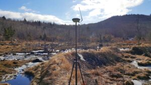
Topographic Surveys are detailed maps of the features of a property. They may include contours, slopes, and other physical attributes like structures, utilities, roads, driveways, bodies of water, boulders, and trees. These surveys are accomplished using specialized technology that directly measures the elevations and features of a property or site. These elevations and features are then represented on a site plan, or a map, that precisely displays the property’s contour lines and attributes.
Reasons for a topographic survey or site plan
Topographic Surveys are useful tools for land developers, designers, engineers, and construction crews, and are often sought for the purposes of planning and designing houses, additions, roads, and driveways. Engineers and architects often utilize topographic site plans to complete their design work for a client, as these tools allow them to easily visualize the land and its features. Federal, state, and local government municipalities also use topographic reports when creating or enforcing zoning regulations.
Related Services
Need a land surveying partner?
Let us be your partner for all your land surveying needs. We can help determine if—and when—you need a survey, and which services are right for you.


