Boundary Surveys
As specialists in land surveying, we perform various types of boundary survey services for residential and commercial property owners and managers in Vermont, New Hampshire, New York, and throughout the northeast. We’re experts in boundary law, land record research, and measurement—providing the highest standards of practice, compliance, and diligence to achieve accurate results.
What is a boundary survey?
Also known as boundary retracement surveys, boundary surveys are used to determine actual boundary lines and corners of an existing property. This process involves intensive land records research, searching for existing physical boundary evidence, measurement, drafting a plat (a map with dimensions of the property), and marking the legally defensible boundaries.
1. Research
We perform exhaustive research of the property, leaving no stone unturned. This includes locating and reading deeds and previous ownership documents, previously completed surveys, and other historical documents that inform our research—sometimes dating back to the 18th century. We perform this same research for all adjacent properties.
2. Boundary evidence recovery
Also called field reconnaissance, boundary evidence recovery combines our research and all available physical evidence on the property to create a map showing the boundary dimensions called for in the land records. This may involve searching for boundary evidence with magnetic locators, survey-grade GPS, and a variety of other tools for accuracy, precision, and efficiency.
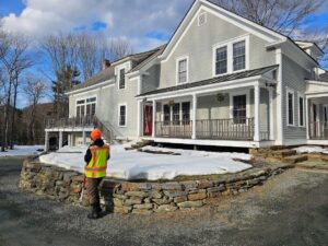
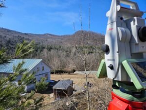
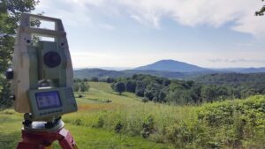
3. Field measurement
Using sophisticated measuring equipment and control methods to ensure thorough and precise data, we perform measurements around the property to obtain the survey data needed to make legally defensible boundary determinations and draft a plat.
4. Plat drafting
Along with aerial imagery, topographic data, historical records, historical maps, and GIS data, we import our own measurement data into AutoCAD drafting software to analyze all the information available to us. We can provide PDF, full-size paper, mylar, .shp shapefile, .dwg drawing file, and almost any other GIS and AutoCAD deliverables.
5. Monumentation
We set new survey monuments to permanently mark the boundaries. At our client’s discretion, these can range from 5/8”x30” rebar to locking aluminum rods with granite bounds. All monuments are capped with aluminum or bronze identifying caps with our license number.
Reasons for a boundary survey
Boundary surveys are performed when homeowners or property managers need to establish where their existing boundaries are. This enables them to identify or clarify the property rights of themselves or others. Clients often request boundary surveys for the following reasons:

- To provide a clear property description in a deed when selling, buying, or gifting land
- To prove compliance with zoning requirements when building a new structure or an addition
- When conserving land
- When undertaking utility projects, like pipelines, water, sewer, etc.
- To establish or relinquish easements (rights of way, etc.)
- To determine a responsible party when their property is impacted by environmental contamination
- To install a fence
- To undergo a construction project
- To settle a dispute with a neighbor or to avoid encroachment to or by a neighbor
FAQs
A: The cost of a surveydepends on a variety of factors: the reason for the survey, the size and shape of the property, and the scope of the work. We can provide services à la carte (research and/or measurement, drafting, etc.), but some services require others to be rendered (we can’t set monuments without recording a survey plat in the land records, measurement is necessary to produce a survey plat, etc.). We provide fixed pricing. If unforeseen circumstances arise, we only proceed with additional work above the fixed price with client approval.
Related Services
Need a land surveying partner?
Let us be your partner for all your land surveying needs. We can help determine if—and when—you need a survey, and which services are right for you.
Serving Vermont, New Hampshire, New York & the Northeast
Holt Gilmour Survey Associates
(802) 457-4649
Locations
Woodstock
PO Box 544
51 Pleasant Street
Woodstock, VT 05091
(802) 457-4649
Williston
PO Box 1261
Williston, VT 05495
(802) 457-4649
Copyright © 2025 Holt Gilmour Survey Associates – All Rights Reserved – Website by Stride Creative Group